Maps of Vurtgoren
The maps that follow record the lands of Vurtgoren as they stand in the Seventh Moon of the Twentieth Year, within the Thirty-Second Cycle of the Second Era. They set forth the borders, regions, and features that shape them.
Vurtgoren — Political Divisions
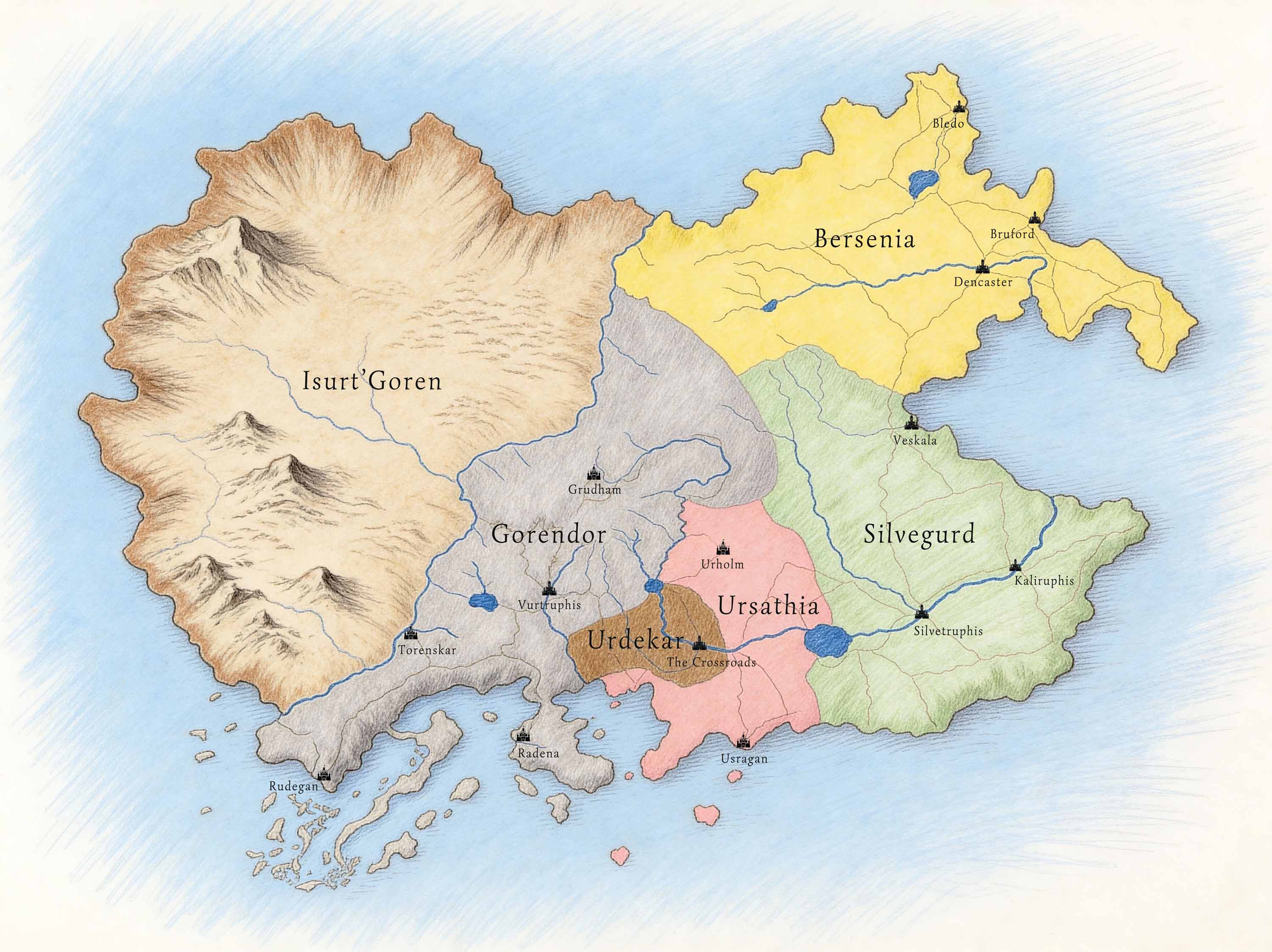
Showing the five nations of the Great Union and the lands beyond the Skar.
Southern Vurtgoren — Political Divisions
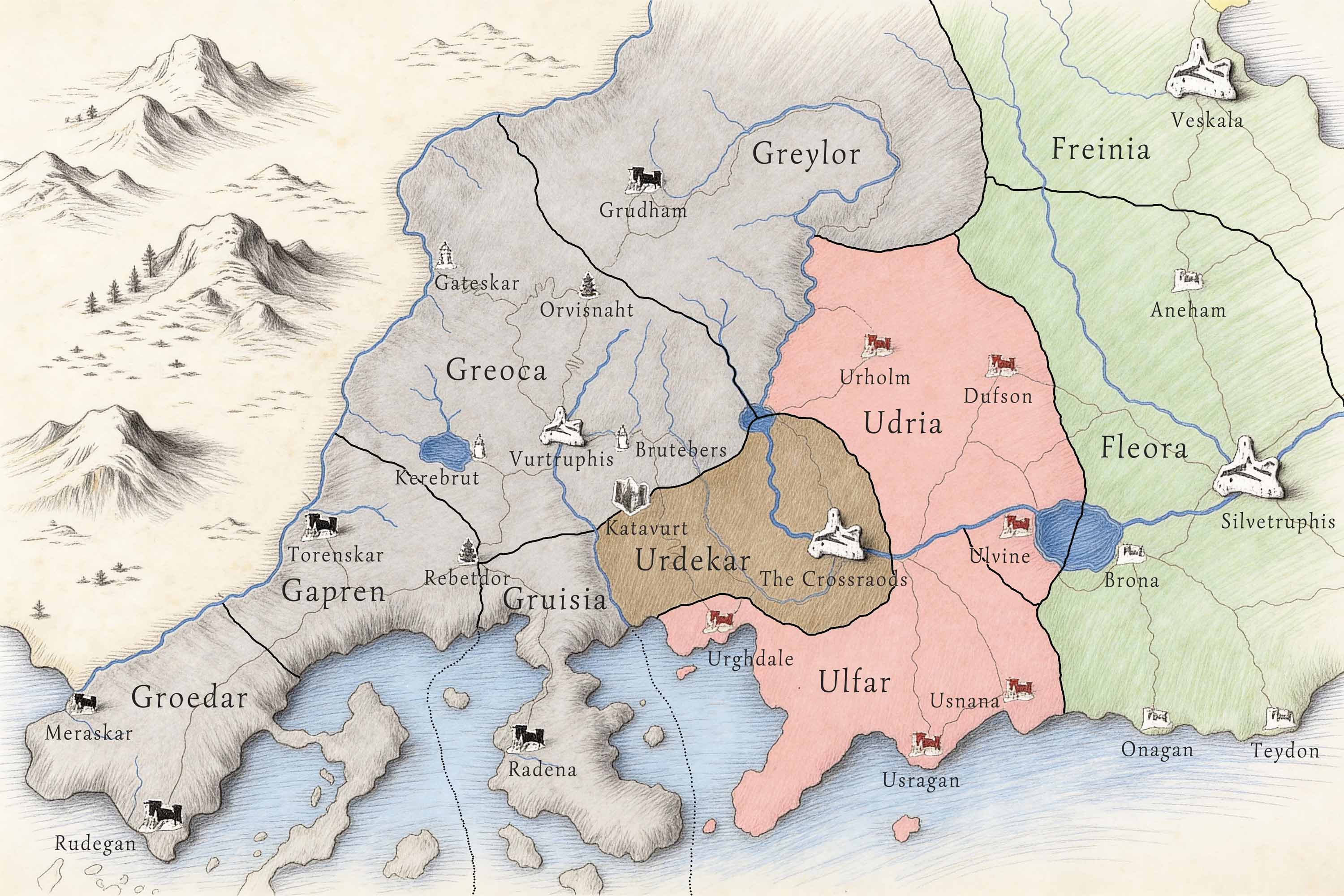
Detailing the regions and internal borders of the southern territories.
Southern Vurtgoren — Relief
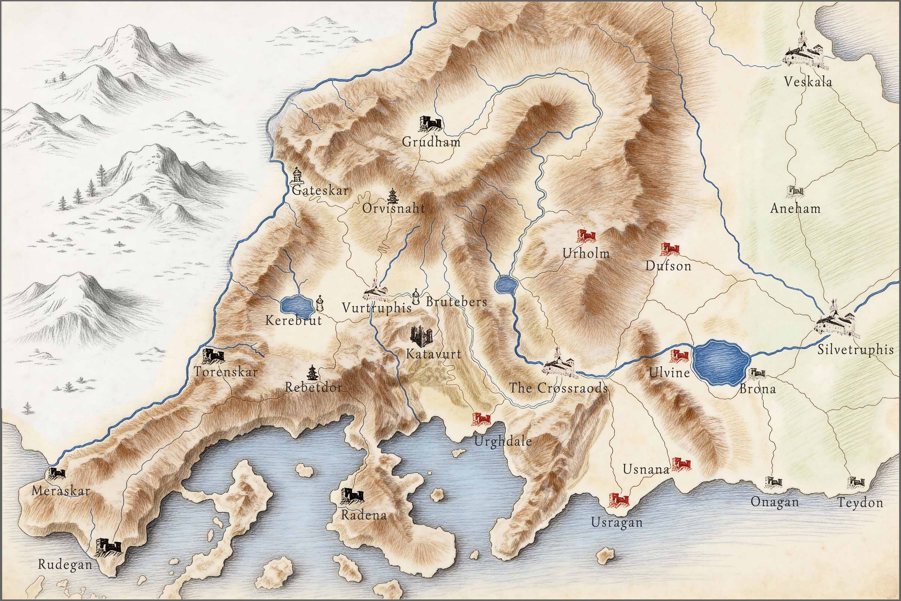
Depicting the mountain ranges and natural formations of the south.